Geocoding
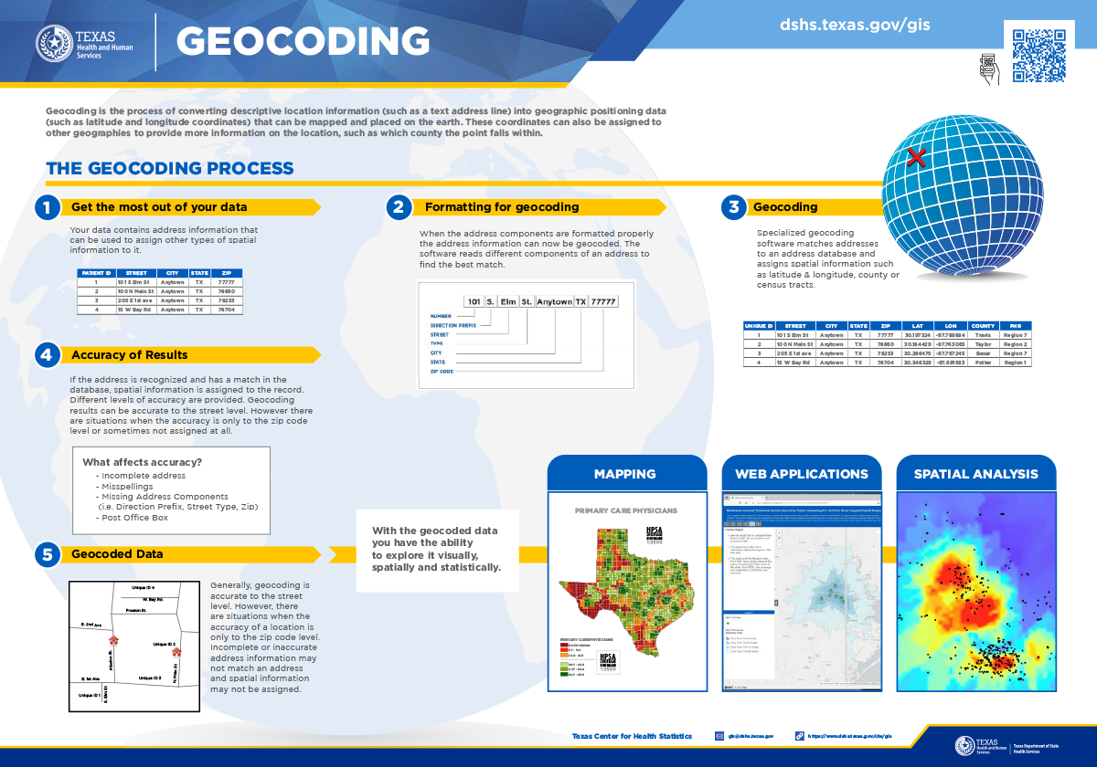
Geocoding is the process of converting descriptive location information (such as a text address line) into geographic positioning data (such as latitude and longitude coordinates) that can be mapped and placed on the earth. These coordinates can also be assigned to other geographies to provide more information on the location, such as which county the point falls within. The example below shows only a few of the many types of spatial information available.
| Input Info | Output Results | ||||||||
|---|---|---|---|---|---|---|---|---|---|
| Address | ZIP | Address | ZIP | Latitude | Longitude | County | Census | PHR | |
| 1100 W 49th St | 78756 | 1100 W 49th St | 78756 | 30.8215 | -97.735514 | Travis | 48453000203 | Region 7 | |
The Center for Health Statistics GIS Team geocodes using Centrus Desktop® and ArcGIS Street Map Premium®. Some examples of public health studies utilizing geocoded data include tracking the spread of infectious and environmentally caused diseases, identifying factors related to low birth weight, and linking client populations to provider locations.