EMS/Trauma Systems Interactive Map
This page provides information about EMS/Trauma Systems Interactive Map .
- EMS Compact
- Applications and Forms
- Open Records Requests
- EMS Careers and Education
-
- EMS Education Providers
- Out of Hospital Do Not Resuscitate Program
- Criminal History
- Data Sources for EMS Trauma Systems
- EMS/Trauma Systems Interactive Map
-
- Emergency Care Attendant Training Funding
- EMS Allotment-Allocation Eligibility
- Extraordinary Emergency Fund
-
- FY 2021 Uncompensated Trauma Care Fund Distribution (Funds 5108 & 5007) – June 2023
- FY 2021 Uncompensated Trauma Care Fund Distribution (5111) - June 2023
- FY 2020 Uncompensated Trauma Care Fund Distribution (5111) – August 2022
- FY 2020 Uncompensated Trauma Care Fund Distribution (Funds 5108 & 5007) – August 2022
- FY 2022 Uncompensated Trauma Care Fund Distribution (Funds 5108 & 5007) – July 2024
- FY 2022 Uncompensated Trauma Care Fund Distribution (5111) – July 2024
- FY 2023 Uncompensated Trauma Care Fund Distribution (Funds 5108 & 5007) – July 2025
- FY 2023 Uncompensated Trauma Care Fund Distribution (5111) – July 2025
-
- GETAC- Air Medical and Specialty Care Transport Committee
- GETAC- Cardiac Care Committee
- GETAC- EMS Education Committee
- GETAC- EMS Medical Directors Committee
- GETAC- Disaster Preparedness and Response Committee
- GETAC- Stroke Committee
- GETAC- Trauma Systems Committee
- GETAC- Injury Prevention and Public Education Committee
- GETAC- Pediatrics Committee
- GETAC- Emergency Medical Services Committee
- GETAC Council
- Texas EMS Trauma Awards
- Texas EMS Line of Duty Deaths
- Texas EMS Trauma News
EMS/Trauma Systems Interactive Map
The EMS/Trauma Systems interactive map allows users to view trauma service area boundaries and other geographical related information for the following:
- EMS Ground and Air Providers
- Hospital Designation Programs
- EMS Education Programs
- DSHS EMS Regional Offices
For questions about the map, please see the step-by-step instructions below or contact EMSInfo@dshs.texas.gov.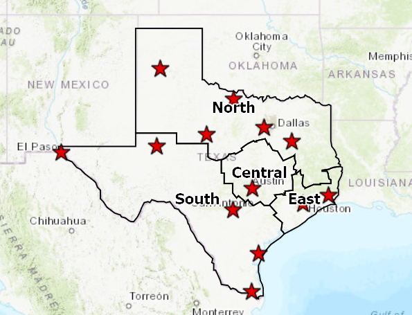
Access the Texas EMS/Trauma Systems Interactive Map
View with historical data layers
Instructions
Texas EMS/Trauma Systems Interactive Map User Guide
Please see the following step-by-step instructions for using interactive map.
- Click the + button on the toolbar to zoom in and then click on the map to view information on your geographic location.
Click the layers button on the top right side of the page to view a list of available program topics.

- Click the box next to your topic to view map information.